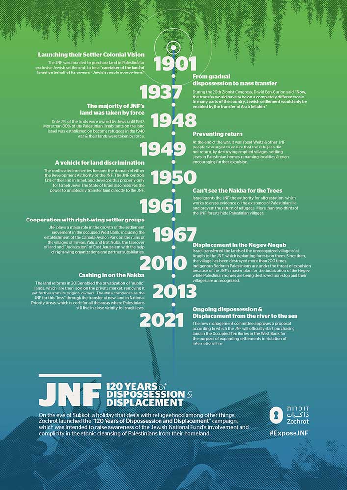
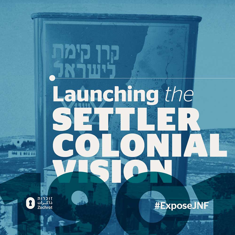
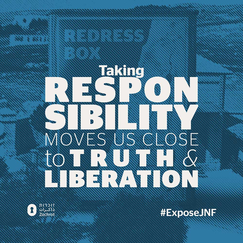
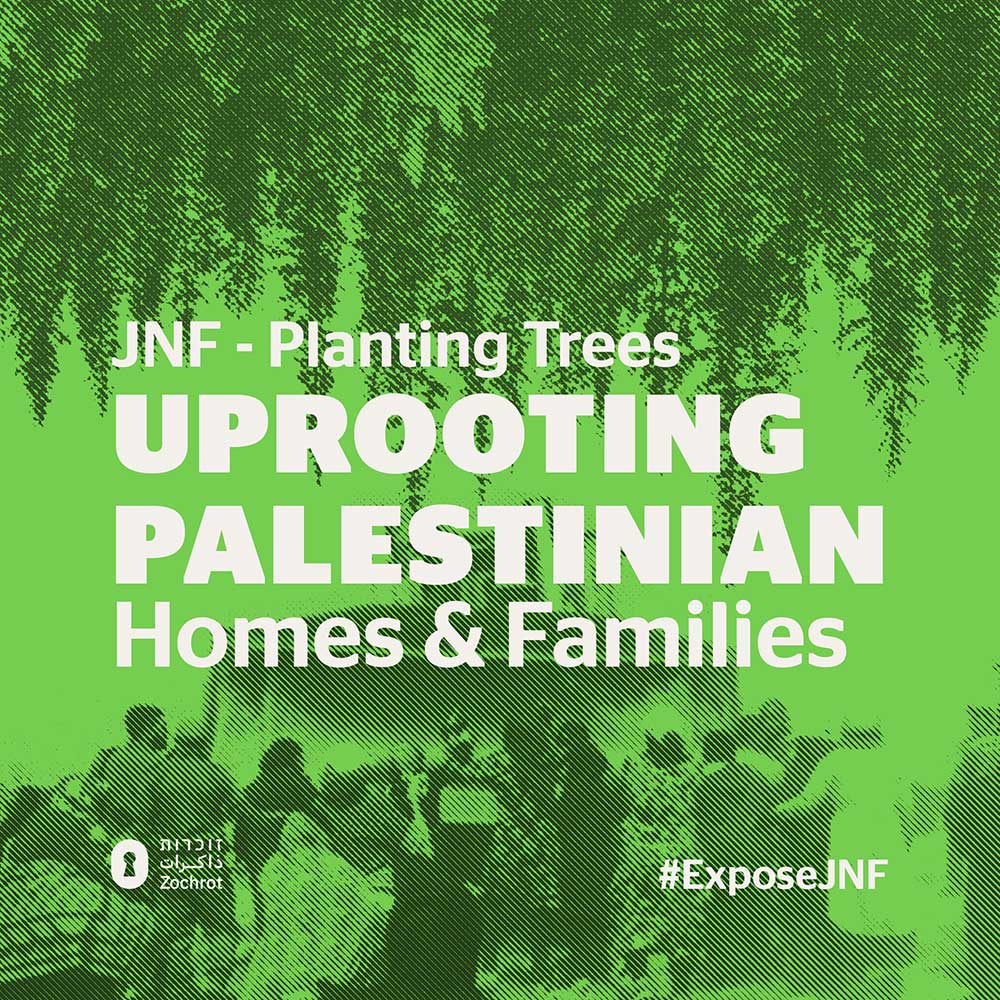
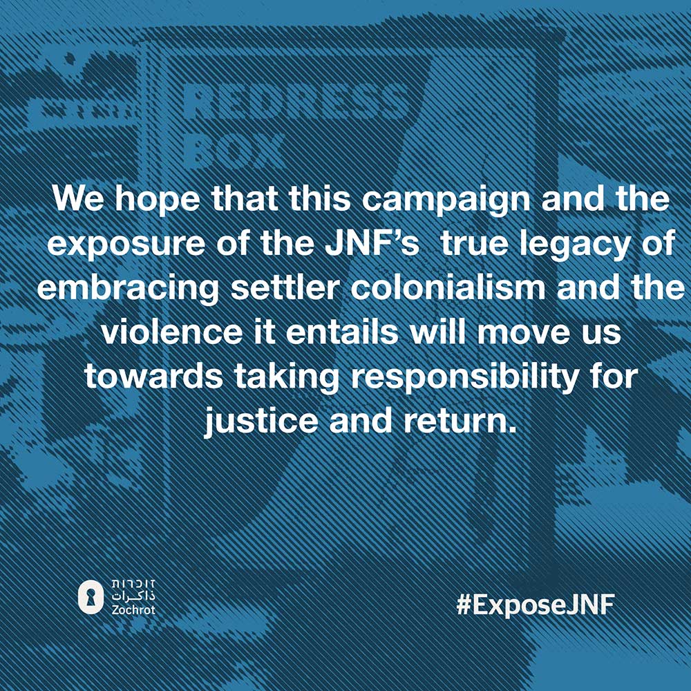
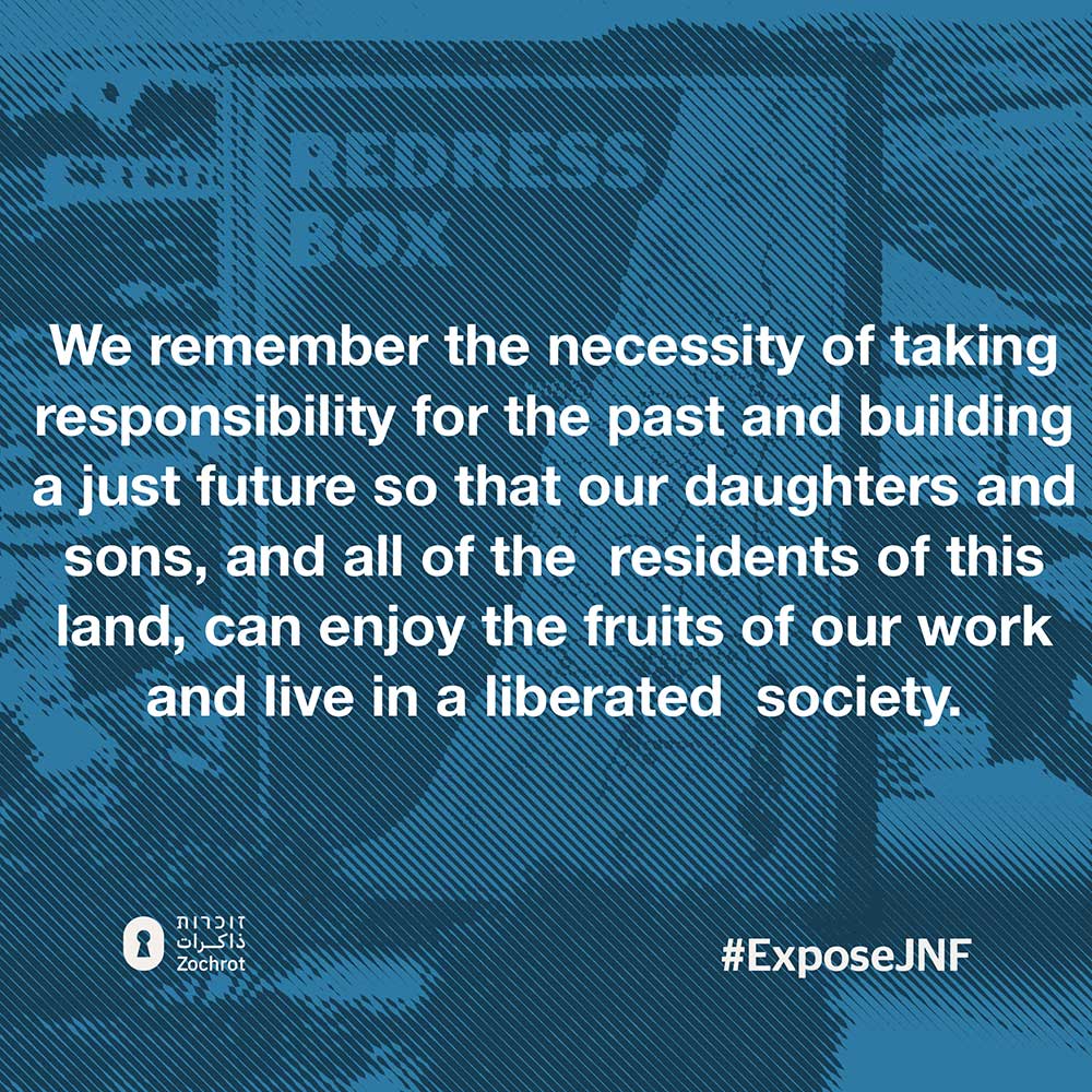
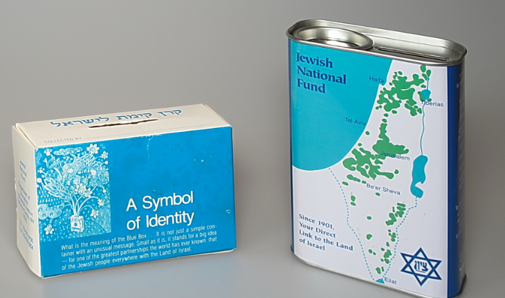
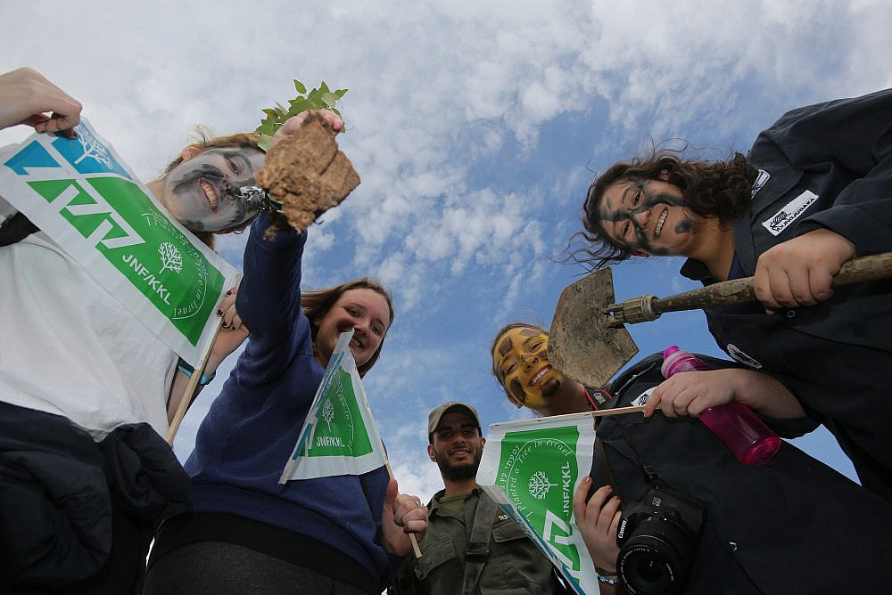
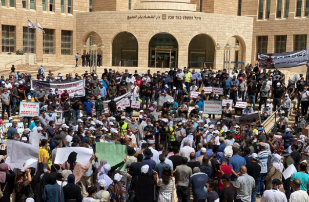
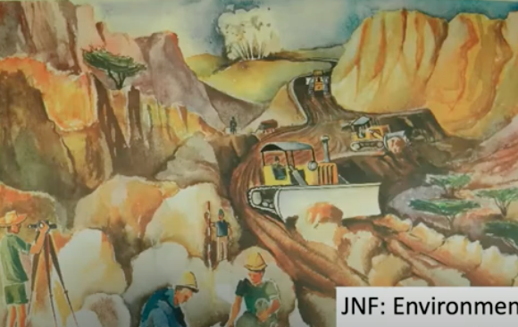
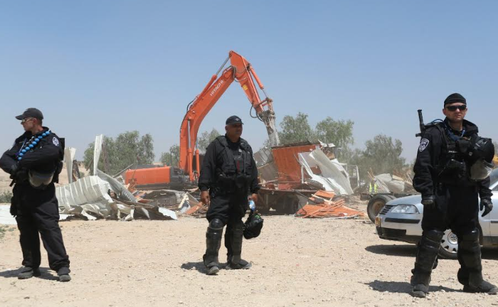
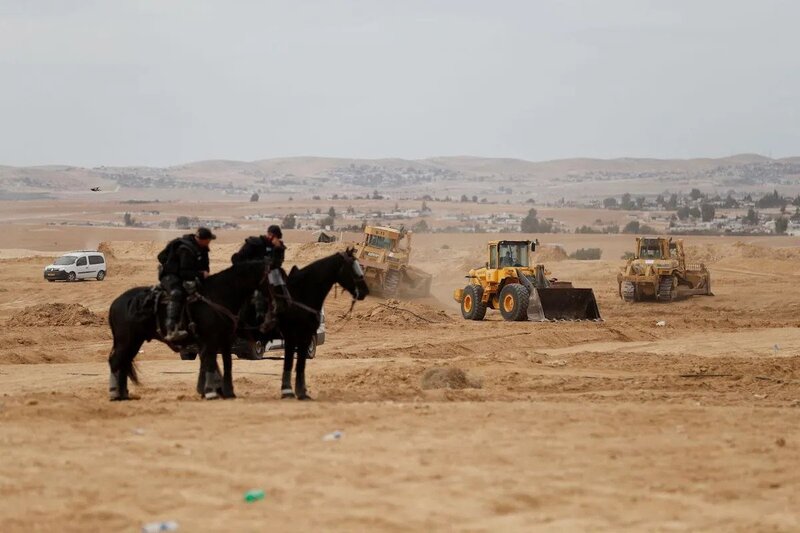
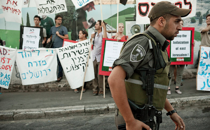
Unmasking JNF Parks
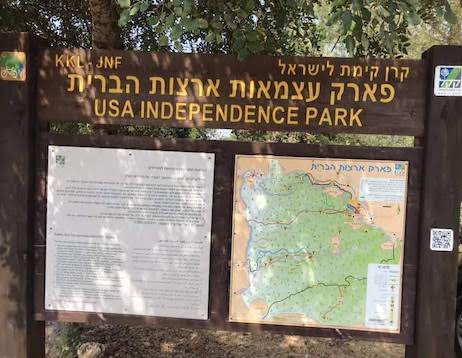
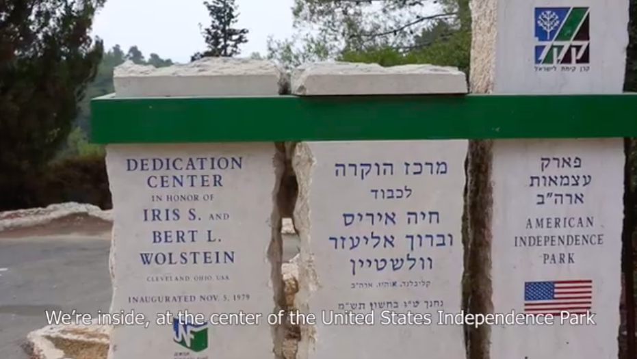
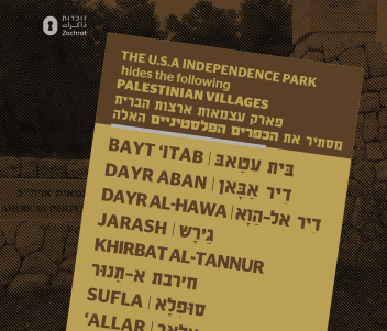
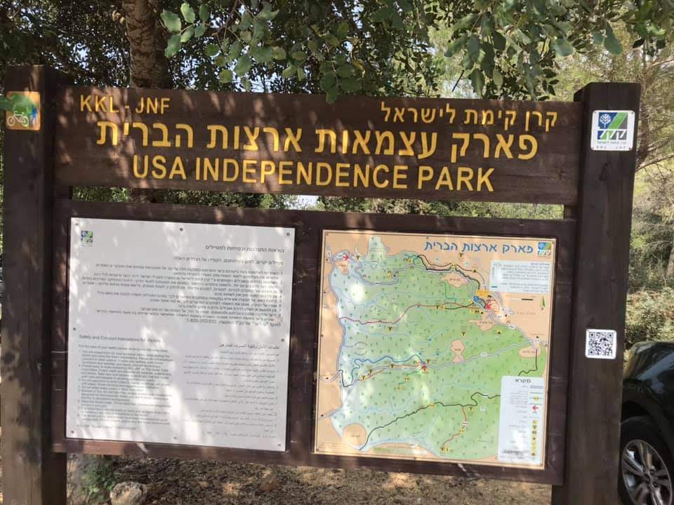
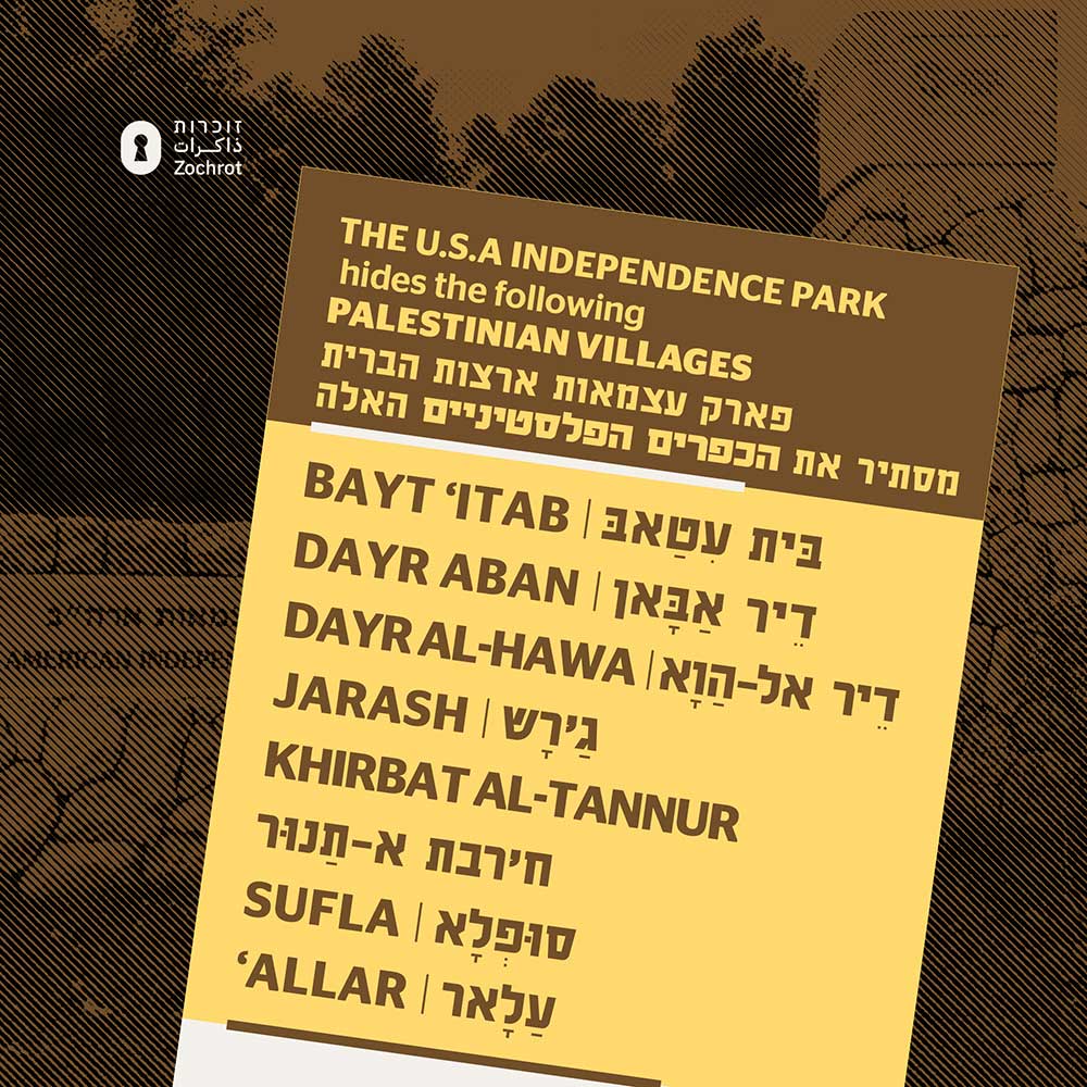
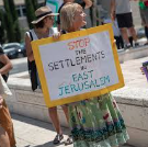
United States Independence Park
The JNF's U.S.A Independence Park draws American people, particularly Jews, into complicity with JNF's actions of erasure and displacement of #Palestinians. The park was developed in 1976 with the help of JNF's friends of USA JNF to mark the close relationship between the U.S and Israel. The U.S.A Independence Park Hides: Allar Dayr al-Hawa Khirbat al-Tannur Jarash, Sufla Bayt 'Itab Dayr Aban
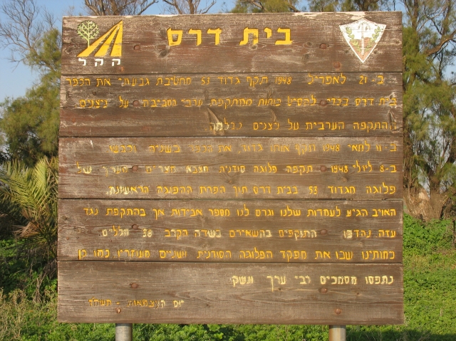
The Jewish settlements of Hasia, Beit Shemesh, Yishai, Sar’a were established on Dayr Aban lands, and in 1976 the JNF's Independence Park was established on them with the help of friends of the USA’s JNF to mark the close connection between the two countries.
The U.S.A Independence Park Hides:
- Allar
- Dayr al-Hawa
- Khirbat al-Tannur
- Jarash
- Sufla
- Bayt 'Itab
- Dayr Aban
Hanita Forest
The Hanita Forest has seized a total of 3,985 donums of Palestinian land.
This made 17.726+ Palestinians refugees, most of whom are in Lebonon today.
For example, the Dunya Yusuf M Jarrar family were forced out of their village, Al Bassa, and found exile in Jenin Town, northern West Bank; the Muhareb Burimi family were forced out of their village, Al Bassa, and found exile in Amman Town North, Jordan.
The Hanita Forest hides:
- Hanita
- Al Bassa & Mas'ub (destroyed during the Ben Ami military operation, 1948)
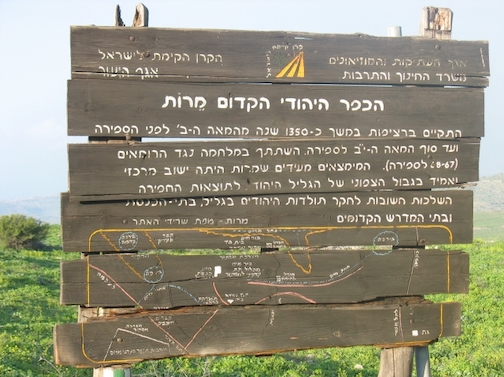
Khirbat Marut
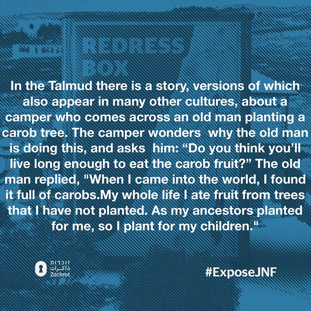
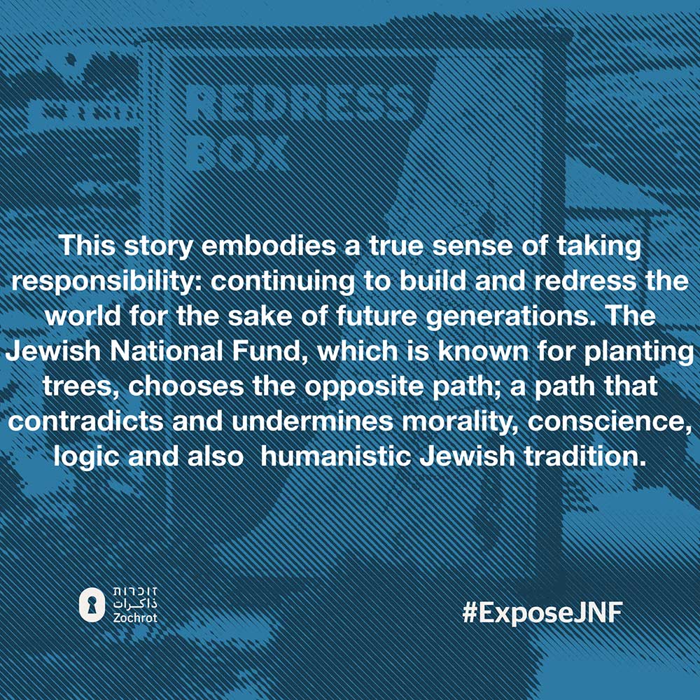
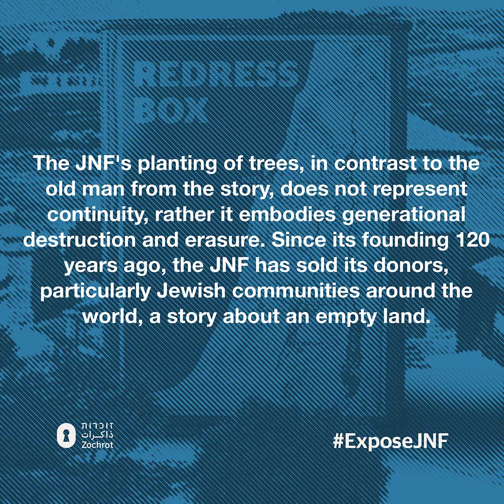
Khirbat Marut, managed by the JNF, now stands on the former site of Marus village, which once thrived on a slope overlooking the al-Hula Plain. Marus boasted agricultural richness, with grain cultivation, fruit orchards, and fig trees dotting its landscape. Traces of its past include the remnants of a synagogue dating back to the seventh century. However, Marus met its demise during the turmoil of the Nakba in 1948 , with Israeli forces prompting the exodus of its inhabitants through attacks and psychological warfare. Today, Khirbat Marut serves as a chilling reminder of this erasure, its very existence obscuring the rich history of Marus. Signs within the area, bearing new names and narratives, contribute to this erasure, perpetuating a selective memory that hides the truth of Marus and its people.
The Khirbat Marut Forest hides:
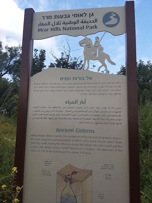
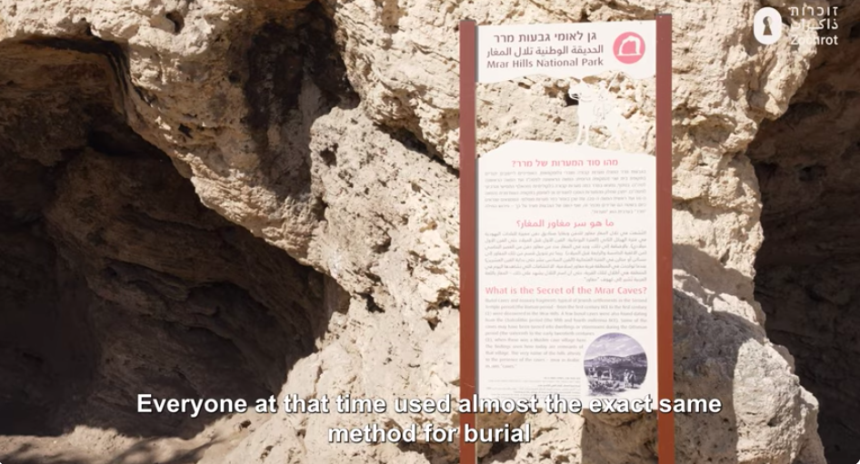
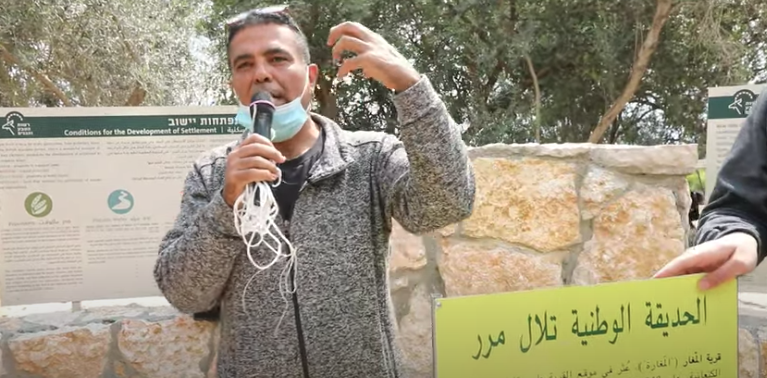
Mrar Hills Park
al-Maghar (“The Cave”). Remains from the Canaanite period have been found on the site of the village. It had 2000 inhabitants in 1948, most of them Moslems. They lived in 280 structures constructed of mud, concrete and stone. The school had 190 pupils. The village had 15,390 dunums of land of which 2,659 had been sold to Jews. al-Maghar was captured on 15 May 1948; the JNF - KKL demolished its buildings. Beit El'azari, a moshav, was established on its land; four of the village buildings still exist and are in use.
The Mrar Hills Park hides:
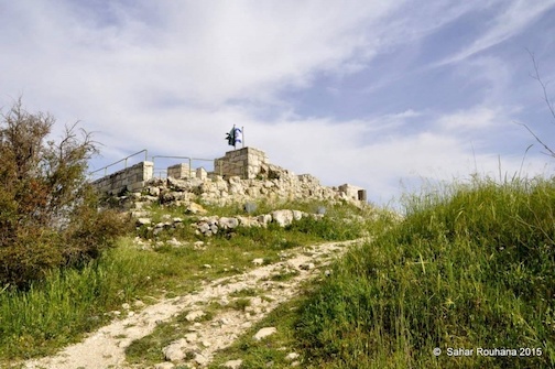
al-Qastal National Park
Al-Qastal National Park - Located on the Palestinian locality of Al-Qastal, this park stands as a stark reminder of the erasure of Palestinian history and heritage.
The village stood on top of a high, rounded hill, overlooking wide expanses in all four directions. It overlooked the al-Quds (Jerusalem)-Jaffa highway to the north and northeast, to which it was linked by a secondary road. Its position over the highway accorded al-Qastal a strategic significance. The village name was derived from the Latin castellum, the term for the Roman castle that was built on the site. The old Roman castle was renovated or rebuilt and named Belveer des Croises during the Crusader period.
The southern, northern, and eastern slopes of the site are covered with stone rubble and the ruins of stone terraces, half-concealed by wild grass. The ruins of the old castle lie on the mountain top. An underground shelter has been built on the site, southwest of the fortress. Olive, carob, and fig trees grow on the north and the west sides of the site, and cactuses grow on the southern side. The entire site, including parts of the fortress, has been turned into a national park and serves as an Israeli tourist attraction.
al-Qastal National Park hides
Zmorot Pond Nature Reserve
Before 1948, Bayt Daras was a thriving Palestinian village located 32 km northeast of Gaza. Its landscape featured a Crusader castle and a Mamluk caravansary, showcasing its rich historical significance. The village had grown to a population of 2,750 people, boasting two mosques, an elementary school, and flourishing agriculture. The village was occupied by Israeli forces in May, leading to the expulsion of its inhabitants. Three Israeli settlements—Azriqam, Emunim, and Giv'ati—were established on its lands, further altering the landscape.
This reserve, managed by the JNF, symbolizes the continued dispossession of Palestinian heritage and the transformation of the landscape. Today, remnants of Bayt Daras are overgrown with vegetation, interspersed with cactuses and eucalyptus trees—a testament to its erasure. As we reflect on the historical injustices faced by Palestinian communities like Bayt Daras, we are reminded of the continuous erasure and dispossession taking place in Gaza and beyond. The ongoing violence and displacement in Gaza represent a modern-day manifestation of the systemic oppression faced by Palestinians for decades.
Zmorot Pond Nature Reserve hides:
Aminadav Forest
Established in the vicinity of Al-Walaja, the Aminadav Forest serves as a stark reminder of the dispossession and displacement experienced by Palestinian communities in the area. Before 1948, Al-Walaja was a thriving village nestled on a large hillside, boasting a population of 655 and a flourishing agricultural economy. However, during the 1948 Arab-Israeli War, the village faced occupation and was eventually handed over to Israel according to the terms of an armistice agreement with Jordan. Israeli settlements, including Aminadav, were subsequently established on the village lands, further altering the landscape. Today, remnants of Al-Walaja, such as a few stone houses and an elementary school, stand as poignant reminders of its past, while the Aminadav Forest conceals the history of dispossession and displacement that occurred in the area.
The site of Al-Walaja is now covered with stone rubble and almond trees, with a spring flowing from a stone-and-concrete structure in the valley. The 1948 Armistice line passes through the southern lands of the village, and refugee shelters built by the United Nations Relief and Works Agency (UNRWA) now stand on the land that became part of the West Bank. The village area has been repurposed as an Israeli picnic site, while the Israeli Canada Park lies north of it, perpetuating the erasure of Palestinian heritage and history. Despite these efforts to conceal the past, the resilience of Palestinian memory endures, calling for acknowledgment and justice for the communities that once thrived in this land.
Aminadav Forest hides

Ramot Isahar Scenic Road
The Ramot Isahar Scenic Road winds its way through breathtaking landscapes, offering panoramic views of the surrounding terrain. However, beneath its picturesque facade lies a troubling history. This road traces its path over the former Palestinian locality of al-Murasas, a community with a rich cultural heritage and deep roots in the land. The presence of the Ramot Isahar Scenic Road serves as a stark reminder of the displacement and erasure experienced by the inhabitants of al-Murasas, whose lives and history have been obscured by the development of this roadway. As travelers traverse this scenic route, it is essential to reflect on the layers of history it conceals and the stories left untold beneath its asphalt surface.
The Ramot Isahar Scenic Road hides:
Naftali Mountains Forest
The Naftali Mountains Forest covers 36,393 dunams of Palestinian land, hiding the villages and lives it erased. Its creation contributed to the displacement of Palestinian communities, whose descendants today number over 77,460, many still refugees in Syria and Lebanon.
Among them, the Mohd Chihadeh family from Al-Buwayziyya found exile in Bedawwi camp (Lebanon), while the Ali Mustafa Hachem family from Al-Khalisa ended up in Nabatieh camp.
The forest also conceals al-Nabi Yusha, Harrawi, Hunin, and Qadas. Al-Nabi Yusha, home to 80 residents, held a sacred site linked to the prophet Yusha (Joshua ben Nun). Harrawi’s 290 Bedouin residents from ‘Arab al-Hamdun and Hunin’s 1,880 people were expelled, their lands taken by Moshav Margaliot and Kibbutz Dan. Stones from Hunin’s homes were repurposed to build “Beit Ussishkin” in Kibbutz Dan.
Qadas, with 450 residents, was depopulated in May 1948, replaced by Kibbutz Yiftah.
Today, the forest masks the ruins of these lost communities, but their memory endures.
The Naftali Mountains Forest hides:
- al-Nabi Yusha
- Al Buwayziyya
- El Manara
- Al Khalisa
- Baysamun
- Hunin
- Mallaha
- Dayshum
- Harrawi
- An Nabi Yusha
- Jahula
- Az Zuq at Tahtani
- Qadas
Kabul Grove
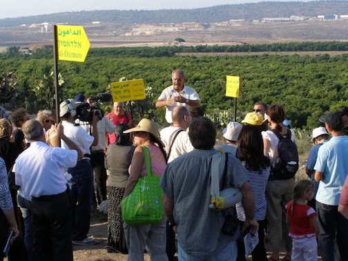
The Kabul Grove, planted on the lands of Al-Damun, illustrates the displacement and renaming of Palestinian localities over time. Al-Damun, once spread across a rocky hill in western Galilee, fell during Operation Dekel in July 1948. The village was completely destroyed, and its inhabitants were expelled or fled amidst the bombardment. Today, the site of Al-Damun is overgrown with vegetation, scattered with rubble, and used for agricultural purposes by the nearby settlement of Yas'ur. Despite the attempts to erase its memory, the remnants of Al-Damun stand as a testament to the ongoing struggle for justice and recognition of Palestinian heritage.
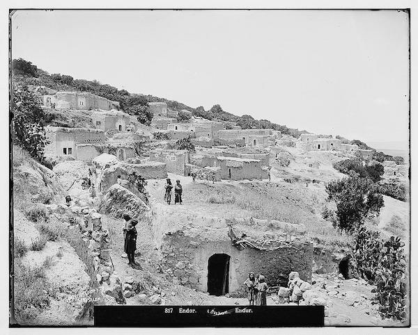
Ein Dor Grove
The JNF Ein Dor Grove, located near Indur, symbolizes the ongoing process of land confiscation and dispossession in Palestine. Indur, situated southeast from Nazareth, faced occupation on May 24, 1948, amidst military assaults and neighboring town fallouts. While there are no Israeli settlements directly on village land, the nearby settlement of Davrat was established in 1946, straddling the boundary between Indur and the village of Dabburiyya.
Today, remnants of Indur include partially ruined walls and thriving groves of date, doum palm, fig, and almond trees—a stark juxtaposition to the surrounding flat lands cultivated by Israelis. The presence of Davrat and the cultivation of village lands underscore the ongoing struggle for recognition and justice for Palestinian communities, amidst the ongoing process of dispossession and land appropriation.
Ein Dor Grove hides:
Tamra Grove
Tamra Grove hides:
Asseret Park
Asseret Park hides:
Eshtaol Forest
Eshtaol Forest hides:
Be'er Nahash
Be'er Nahash hides:
HaHamisha Forest and Neve Ilan Forest
HaHamisha Forest and Neve Ilan Forest:
Qula Forest
The JNF's Qula forest stands as a poignant testament to the Palestinian village of Qula, which once thrived with a population of 1,170 inhabitants until its capture following intense fighting in July 1948. Among its notable residents was Hassan Salameh, a legendary fighter whose legacy echoes through the ages. Tragically, the village's buildings were repurposed by the Israeli Occupation Forces for military training in urban combat, erasing traces of its vibrant past. In the aftermath of its destruction, Givat Koah was established on Qula's site, although it was later relocated to nearby Al Tira (Ramleh). Today, amidst the forest's lush greenery, remnants of Qula's history endure, including traces of a Crusader fortress, a sprawling khan, and the resilient olive trees, fig trees, and prickly pear cacti planted by its former inhabitants—a poignant reminder of a community that once flourished in this land.
The Qula Forest hides:
Tsipori Forest
The Tsipori Forest has seized a total of 12,249 donums of Palestinian land.
This made 56,173+ Palestinians refugees, most of whom are in Syria, Jordan and Lebonon today.
For example, the Adnan Mahm Mawed family were forced out of their village, Nahalal & Shimron, and found exile in Midan; the Hasan Ali Bitari family were forced out of their village, Nazareth, and found exile in Yarmouk, Syria.
The Tsipori Forest/Grove hides:
- Safuriyya (destroyed during the Dekel and Ya'ar military operation, 1948)
- Illut (destroyed during the Dekel and Ya'ar military operation, 1948)
- Al Mujaydil
- Bayt Lahm
- Ginneigar
- Kefar Ha Horesh
- Ma’lul
- Nahalal & Shimron
- Nazareth
- Sarid \ Khuneifis
- Umm Qubei( Kh. Malta)
- Yaffa/ Nazareth
Hodaya Recreation Area
Hodaya Recreation Area hides:
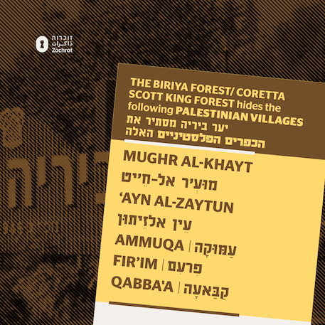
Biriyya - Coretta Scott King Forest
The JNF presents the Coretta Scott King Forest as a beacon of "peace and justice," but it conceals the destruction of Palestinian villages, including Ayn al-Zaytoun, whose residents were killed and expelled with JNF involvement.
For example, the Said Mohd Dakwar family were forced out of their village, Qaddita, and found exile in Nahr El Bared Camp, north Lebanon; the Mahm Yusu Sweid family were forced out of their village, Dallata, and found exile in Yarmouk camp, Syria.
The Birya forest, now renamed the Coretta Scott King Forest, is one of Israel's largest man-made forests, built over a dozen of obliterated Palestinian villages in the Safad region. These villages like Dayshym, Alma, Qaddita, Birrya, Amqa, and Ain al-Zaitoun—were all erased during the Nakba, their inhabitants massacred or driven out. Ayn Al-Zaytun witnessed a horrific massacre that claimed 70 lives, immortalized in Elias Khoury's novel 'Bab el Shams' and its film adaptation.
The Biriyya Forest has seized a total of 17,673 donums of Palestinian land.
This made 51,894 Palestinians refugees, most of whom are in Syria and Lebonon today.
The Birya/Coretta Scott King Forest Hides:
- Qaddita
- Taytaba
- Fir'im
- Ayn al-Zaytun
- Ammuqa
- Qabba'a
- Mughr al-Khay
- Dallata
- Al Ja’una
- Safad
- Biriyya (destroyed during the Yiftah military operation, 1948)
- Edh Dhahiriya el Fauqa
- Ein Zeitim
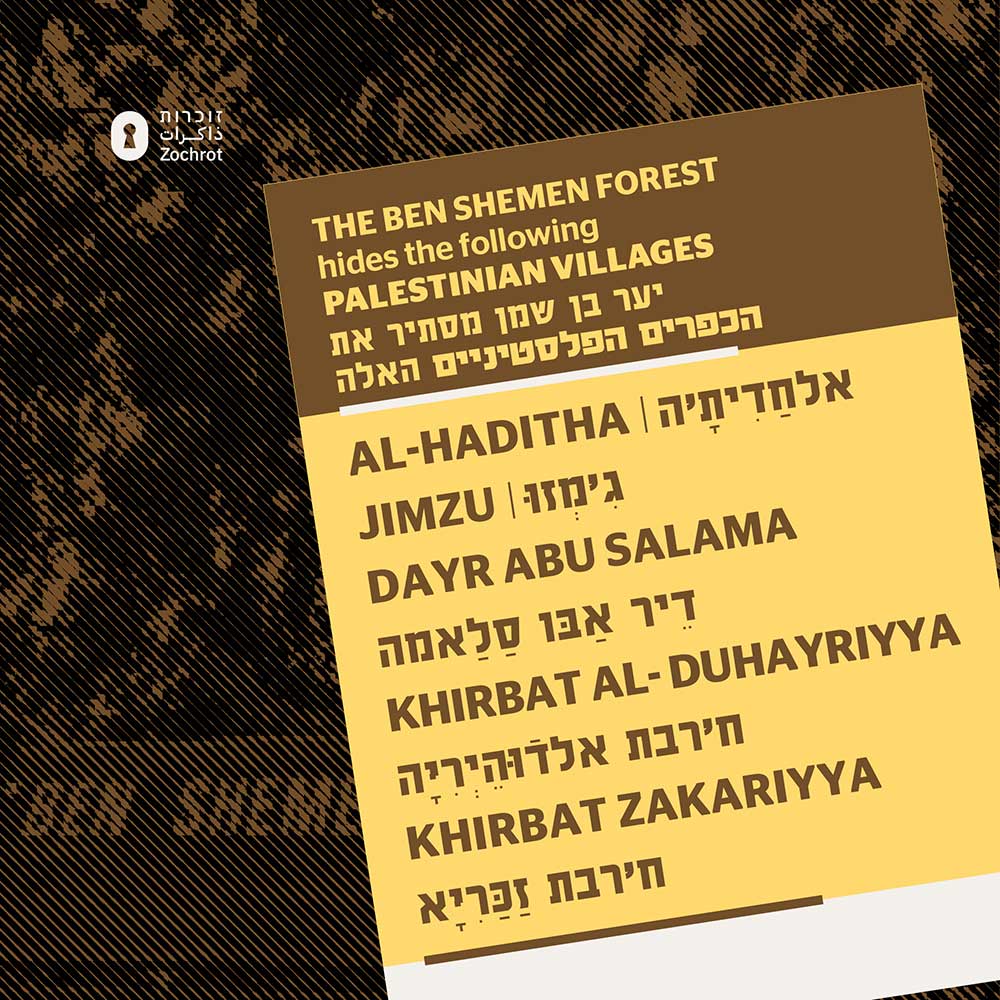
Ben Shemen Forest
The Ben Shemen Forest, managed by the Jewish National Fund (JNF), stands as a testament to the organization's complicity in concealing Palestinian localities and their remains. Once home to thriving Palestinian communities, the park now covers up their existence, serving as a symbol of erasure and denial. Beneath the serene landscape lies the buried history of villages like Khulda, Qatra, and 'Aqir, whose traces have been systematically effaced. Instead of acknowledging the past, the park offers recreational facilities and picnic areas, masking the truth of dispossession and displacement.
The Ben Shemen Forest hides:
- Jimzu
- Dayr Abu Salama
- Khirbat Zakariyya
- Haditha
- Khirbat al-Duhayriyya

Bar'am Forest
The Bar'am Forest Forest has seized a total of 10,182 donums of Palestinian land.
This made 21,407+ Palestinians refugees, most of whom are in the West Bank, Jordan, and Lebonon today.
For example, the Rida Khaled Marmar family were forced out of their village, Fara, and found exile in Rashidieh Camp, Lebanon; the Abdulla Mahm Ayub family were forced out of their village, Jish, and found exile in Chatila camp, south Lebanon.
The Thunder Forest hides:
- Er Ras al Ahmar
- Fara
- Jish
- Kafr Bir’im
- Rihaniya
- Saliha
Hagilboa Forest
Hagilboa Forest hides:
Hakdoshim Forest
Hakdoshim Forest hides:
- Aqqur
- Dayr 'Amr
- Bayt Umm al-Mays
- Khirbat al-'Umur
- Kasla
Hof Hacarmel Forest
The Hof Hacarmel Forest has seized a total of 8,446 donums of Palestinian land. This made 53,224+ Palestinians refugees, most of whom are in Syria, Jordan, Lebanon and the West Bank today. For example, the Fayez Mohd Diab Abu Arab family were forced out of their village, Jaba, and found exile in Waqqas; the Machhur Hazza Qasem Mohd family were forced out of their village, Ijzim, and found exile in Huson.
Hof HaCarmel Forest stands as a testament to the displacement of Palestinian communities, including ‘Ayn Ghazal, Jaba, and al-Sawamir. ‘Ayn Ghazal, once home to 2,520 residents and expansive lands, now sees only a few refugees residing in Fureidis, tending to the tomb of Sheikh Shehade that remains as a poignant reminder of their lost village. Moshav Ofer and part of Moshav ‘Ain Ayala now occupy the lands that once belonged to ‘Ayn Ghazal.
Similarly, Jaba, with its 1,320 inhabitants, met a similar fate, as Geva Carmel now stands on its former land. The fate of al-Sawamir remains largely unknown, save for the fact that part of Moshav Ofer now occupies its territory.
These villages fell victim to attacks from air, sea, and land in July 1948, during a declared truce in the fighting, marking a tragic chapter in Palestinian history. Today, Hof HaCarmel Forest conceals the scars of this displacement, serving as a somber reminder of the ongoing struggle for recognition and justice.
The Hof Hacarmel Forest hides:
- Ayn Ghazal
- al-Sawamir
- Jaba
Hazorea' Forest
Hazorea' Forest
Haruvit Forest
Haruvit Forest hides:
Kfira Forest
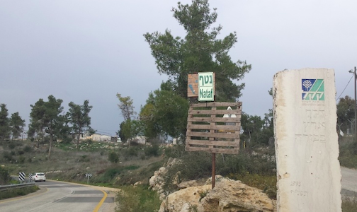
Kfira Forest stands as a silent witness to the erasure of Palestinian villages, including Bayt Thul and Nitaf. Bayt Thul, with its 300 residents and lush agricultural lands, fell victim to displacement, with a portion of its territory already acquired by Jewish settlers prior to the establishment of the state. Nitaf, home to 50 inhabitants, shared a similar fate, as members of the Ibrahim family from Abu Ghosh saw their lands transformed into the Nataf communal settlement.
The capture of both villages between April and July 1948 marked a tragic chapter in Palestinian history, as families were uprooted and communities dispersed. Today, Kfira Forest conceals the remnants of these villages, their stories etched into the landscape as a reminder of the ongoing struggle for justice and remembrance.
The Kfira Forest hides:
Kfar Hahoresh Forest
Kfar Hahoresh Forest:
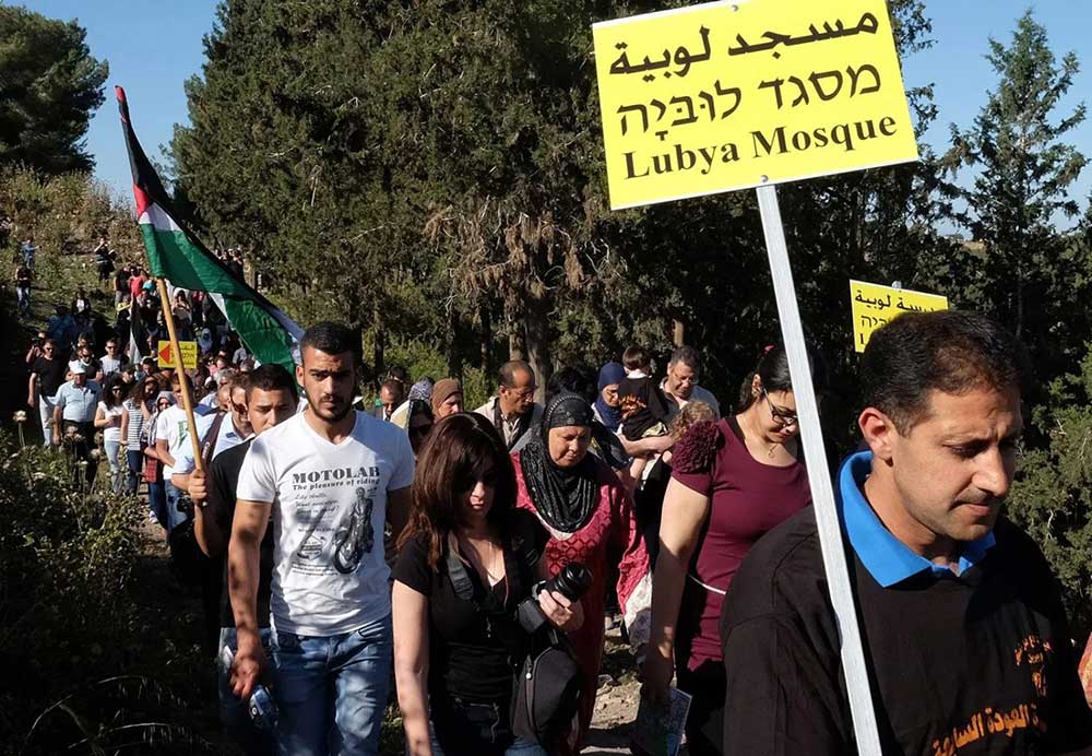
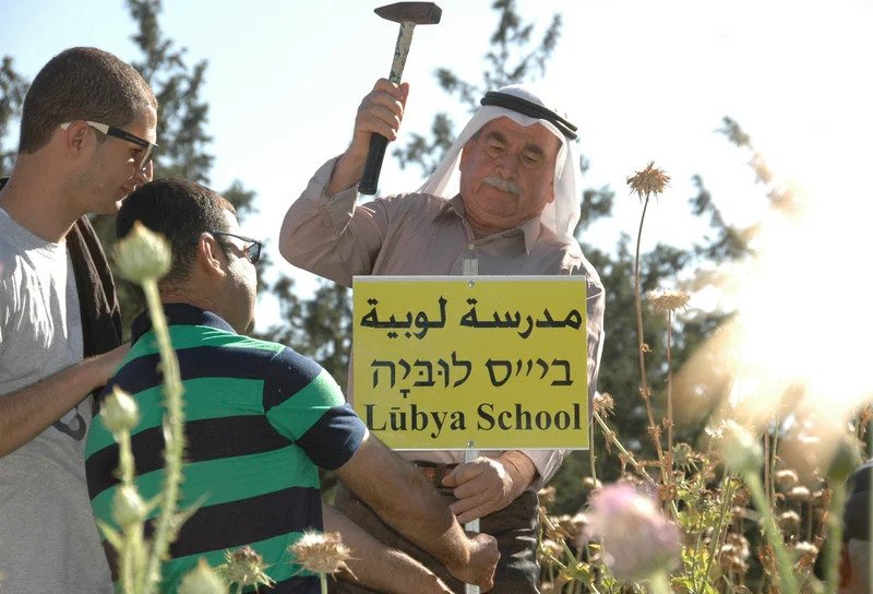
Lavie Forest
Lavie Forest, now covering the erasure of Lubya village, stands as a poignant testament to the rich heritage that once graced this land. Lubya, a bustling Palestinian village, nestled in the northern reaches of historic Palestine, was renowned for its hilltop architecture, olive groves, and vibrant community life. Its strategic location near the Golani interchange bore witness to centuries of history, from its medieval roots to its significance during the Ottoman era.
Despite its storied past, Lubya was occupied in the 1948 war, facing intense battles and eventual expulsion. Today, the remnants of Lubya are obscured beneath the pine trees of Lavie Forest, a silent witness to the tragedy of displacement and dispossession. Kibbutz Lavie and other settlements now inhabit its lands, while the memory of Lubya's refugees persists across the globe.
The tale of Lubya reflects the broader narrative of Palestinian dispossession, where legal mechanisms such as the Absentees' Property Law served to cement the loss of ancestral lands. Yet, amidst the silence and denial, the spirit of Lubya lives on, resonating in the voices of its dispersed descendants and the echoes of its silenced history.
The Lavie Forest has seized a total of 2,949 donums of Palestinian land.
This made 36,936+ Palestinians refugees, most of whom are in Syria, Jordan and Lebonon today.
For example, the Ali Ahmad Zureini family were forced out of their village, Tur'an, and found exile in Ein El Hilweh Camp, south Lebanon; the Mahm Dayes Ibrm family were forced out of their village, Al Shajara, and found exile in the Dera Villages, southern Syria.
The Lavie Forest hides:
Megido Forest
al-Lajjun was captured in May, 1948. It had 1,280 inhabitants whose ancestors had come from Umm al-Fahm. The village had 77,000 dunums of land. Villagers cultivated grains, vegetables and citrus. There were two mosques, a market, a clinic, a khan, a school and shops. Six flour mills were powered by water from the nearby springs and wadis. Kibbutz Megiddo was established on land of the village, some of whose buildings still serve the kibbutz. A famous Israeli children’s story recounts the story of Pluto, a puppy from Kibbutz Megiddo who ran away and came to a pond. It was probably the al-Hajja spring in al-Lajjun.
The Megido Forest hides:
Sataf Forest
Sataf forest, once home to 630 inhabitants until its capture in July 1948, remains a captivating destination today, albeit lacking sufficient historical context on-site. Nearby lies Khirbat al-Lawz, which boasted 520 residents and 4,502 dunums of land. Amidst its ruins, a majestic ancient carob tree stands witness to bygone village life, where weddings and celebrations once flourished. Despite attempts to establish a new locality, Luzim, the village remains a haunting reminder of its past, with crumbling walls and collapsed roofs preserving fragments of its history.
Yet, the history of these villages is intentionally concealed, with the area now part of the Sataf forest, an extension of the Moshe Dayan Park. The Jewish National Fund's involvement in planting this forest serves to obscure the traces of Khirbat al-Lawz's existence, weaving its story into the broader narrative of Israeli landscapes. The landscape, adorned with almond, olive, and fig trees, as well as cacti, is now intertwined with the forest, creating a layered tapestry of history and erasure, where the past is both preserved and obscured by the present.
The Sataf Forest hides:
- Sataf
- Khirbat al-Lawz
- A'qqur
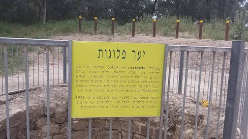
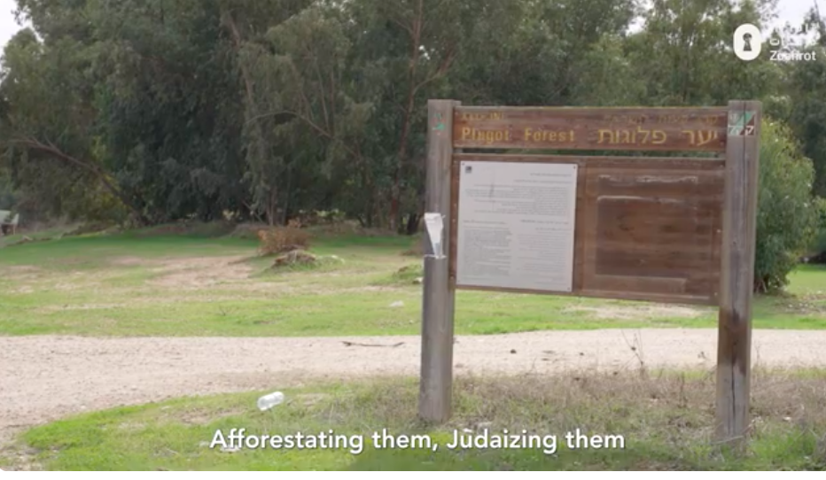
Plugot Forest
The Plugot Forest conceals the remains of vibrant Palestinian communities like al-Faluja and Karatiyya, where thousands once lived and thrived. Al-Faluja boasted bustling markets, schools, and essential services, while Karatiyya nurtured its educational institutions and agricultural heritage. Yet, in 1948, these communities faced expulsion and displacement. Today, their memory is obscured by rows of trees, with new Israeli settlements like Sderot and Or HaNer rising on their lands. The establishment of moshavim like Revaha, Shahar, Nahora, and Komemiyut further obscures the history of these lost villages, perpetuating the erasure of Palestinian heritage.
The Plugot Forest hides:
Tsor'a (Hanasi) Forest- the President forest
Tsor'a Forest - The President - has seized a total of 9,831 donums of Palestinian land.
This made 46,905+ Palestinians refugees, most of whom are in the West Bank and Jordan today.
For example, the Ali Jabr Ah Abu Amer family were forced out of their village, Dayr Rafat, and found exile in Jabal Husein Camp, Jordan; the Abdulla Must Nassar family were forced out of their village, Ishwa, and found exile in Amman Town North, Jordan.
Tsor'a (Hanasi) Forest - The President - hides:
- Bayt Susin
- Dayr Aban
- Dayr Rafat (destroyed during the Dani military operation, 1948)
- Ishwa’
- Islin
- Kherbat Ism Allah
- Sar’a (destroyed during the Dani military operation, 1948)
Kiryat Ata Forest
Kiryat Ata Forest hides:
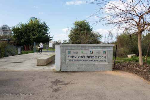
Rosh Tsipor Forest (Hayarkon Park)
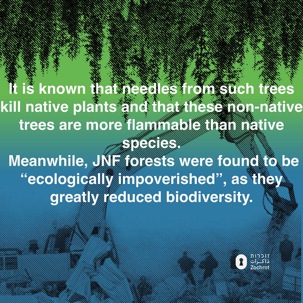
Rosh Tsipor Forest, nestled within Ganei Yehoshua, stands as a testament to the rich Palestinian heritage of the locality Jarisha. Spanning approximately 500 dunams (125 acres), this forest, now forming part of Hayarkon Park, once boasted a diverse array of native flora. However, the landscape has undergone significant alteration over time, as native trees have been replaced with eucalyptus and North Indian rosewood trees (Dalbergia sissoo). This change not only contributes to the erasure of the original landscape but also harms the environment, disrupting local ecosystems and reducing biodiversity.
Hayarkon Park hides:
Segev Forest
The Segev Forest has seized a total of 22,853 donums of Palestinian land.
This made 11,821+ Palestinians refugees, most of whom are in Syria and Lebonon today.
For example, the Ahmad Mohd Abu Atiqa family were forced out of their village, Kabul, and found exile in Qana camp, south Lebanon; the Fadl Yusuf Nimr family were forced out of their village, Mi'ar, and found exile in Qeimar camp.
The Segev Forest hides:
- Mi'ar
- Kabul
- Kaukab
- Mi’ar (destroyed during the Dekel military operation, 1948)
- Sakhnin
- Sha’b (destroyed during the Dekel military operation, 1948)
- Tamra
Hacarmel Forests
The Carmel Forest has seized a total of 17,764 donums of Palestinian land.
This made 126233+ Palestinians refugees, most of whom are in Syria, Jordan and Lebonon, and the West Bank today.
For example, the Husein Chihab Assad Qabsi family were forced out of their village, BaladAsh Sheikh, and found exile in Souf camp, Jordan; the A Fattah Zeidan Mutlaq family were forced out of their village, Daliyat El-Carmel, and found exile in Harima.
The Carmel Forest hides:
- Khirbat al-Damun
- Isfiya
- Al Khureiba
- At Tira
- Ayn Haud (destroyed during the Bi'ur Chametz military operation, 1948)
- Balad ash Sheikh
- Daliyat El-Carmel
- Ijzim Kh. Ad Damun
- Umm az Zinat (destroyed during the Bi'ur Chametz military operation, 1948)
- Yajur
- Umm al-Zinat
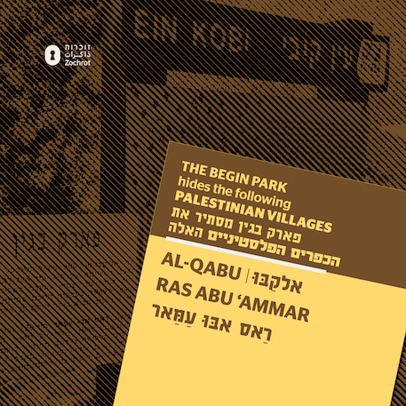
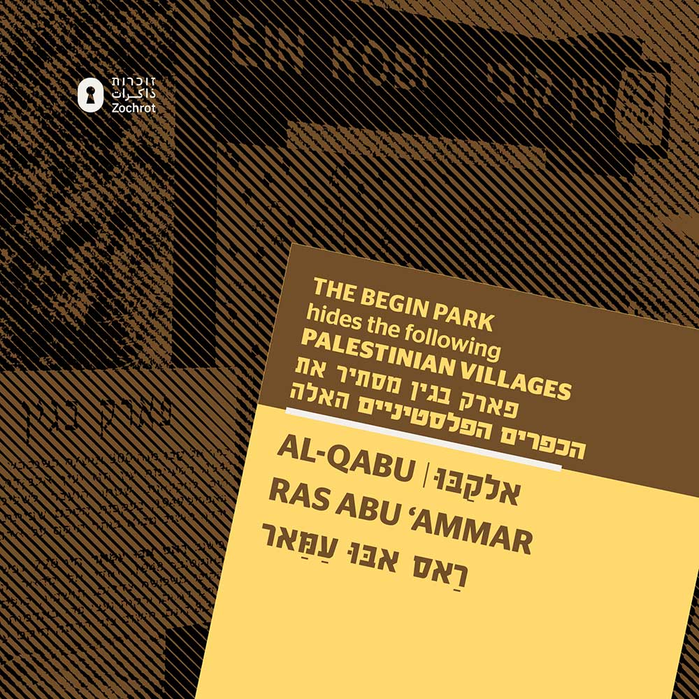
Begin Park
Begin Park spans 9,324 dunams of Palestinian land, taken from the villages of Husan, al-Walaja, and ‘Ayn al-Qabu.
Its establishment displaced over 31,706 Palestinians, most of whom are still in exile in the West Bank and Jordan.
For example:
-
The Ismail Abdulla Husein Hamamreh family were expelled from Husan and now live in Sur Baher, West Bank.
-
The Marwan Saleh A Rahman Jeidi family were expelled from al-Walaja and now live in Dheisheh Refugee Camp, West Bank.
What Begin Park hides:
The site is rich with visible ruins of homes and village infrastructure, standing as silent witnesses to the ethnic cleansing that took place. Scattered throughout the area are olive, almond, and pine trees—some planted long before Israeli afforestation efforts. On the southeastern edge, the village cemetery is still discernible, with seven graves visible and bones exposed in some of the open ones.
The village mosque remains standing but is abandoned and neglected. In its courtyard lies an artificial pool with steps, and behind the mosque are three wells. Nearby stands the shrine of Shaykh al-‘Umari, adjacent to an old irrigation system. A set of stone stairs descends to the arched entrance of the ancient spring of ’Ayn al-Qabu. Much of the surrounding land has been covered by a forest planted by the Jewish National Fund, concealing the history beneath.
What appears today as a peaceful nature reserve is, in reality, a site of destruction and dispossession—one where the landscape has been deliberately manipulated to obscure the memory of the Palestinian communities who once lived there.
Begin Park hides:
The Begin Park Hides:
- al-Qabu
- Ras Abu 'Ammar
- Al Walaja
- Aqqur
- Battir
- Dayr ash Sheikh
- Husan
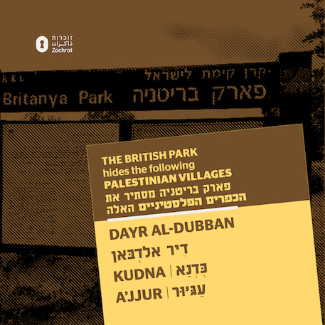
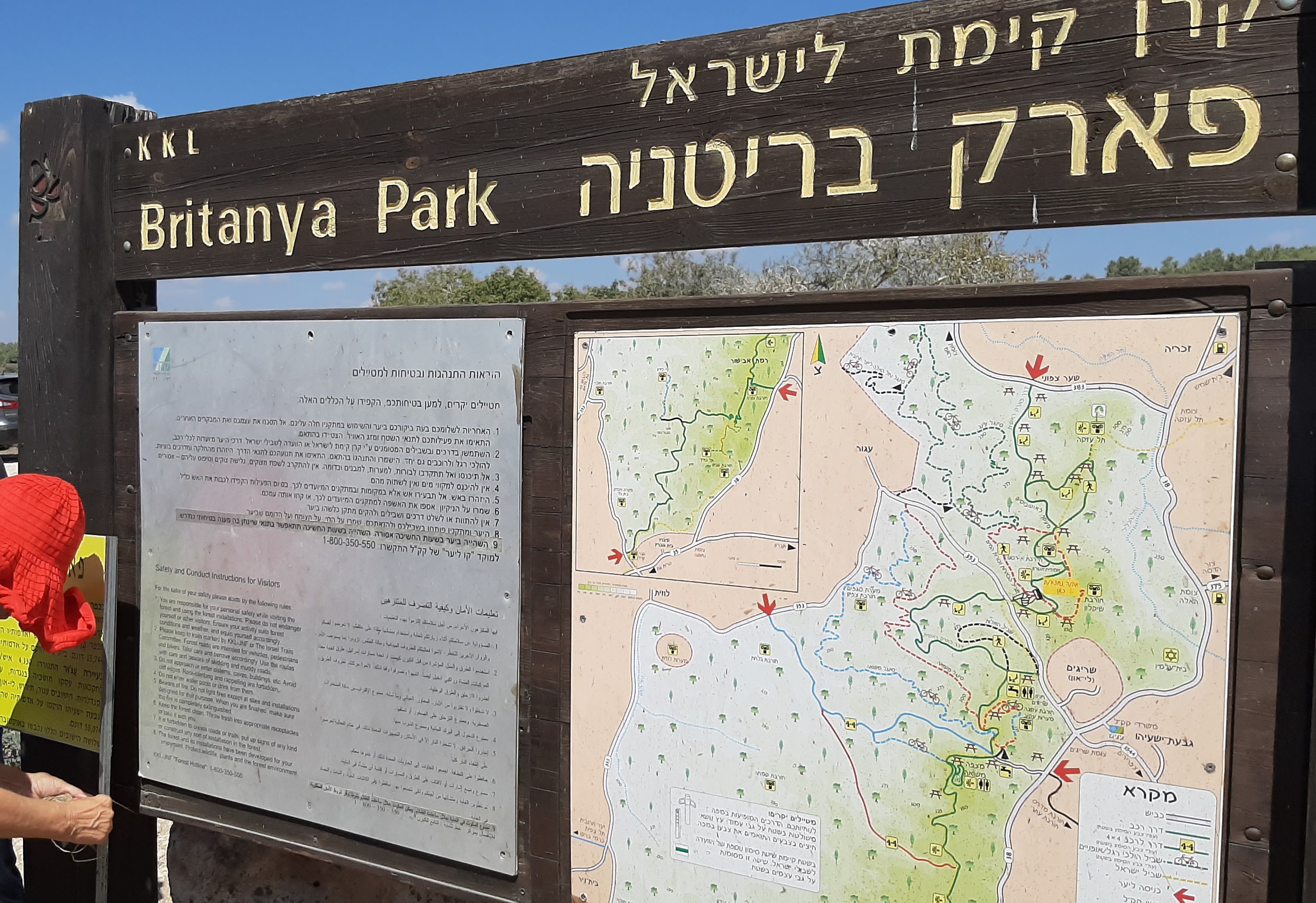
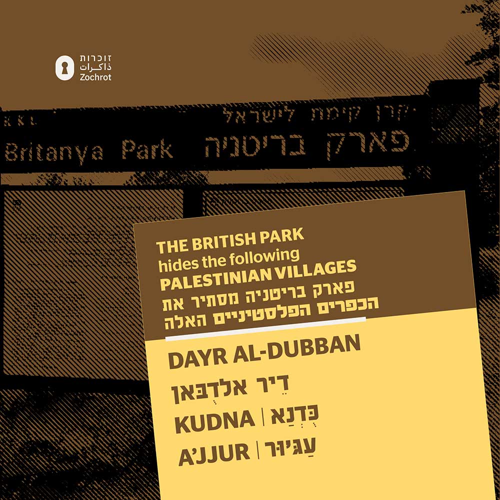
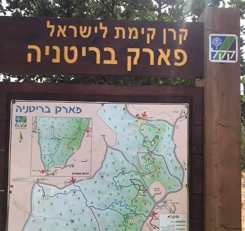
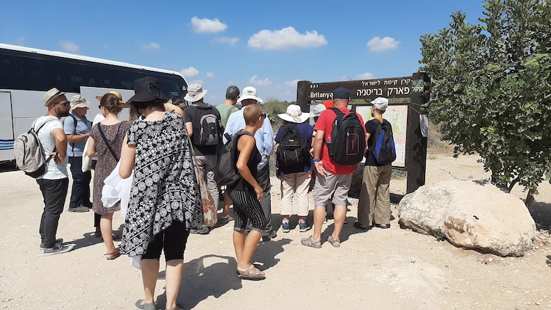
Britanya-British Park
Britannia Park spans across at least 43,430 dunams of Palestinian land, encompassing the remains of numerous ethnically cleansed villages in the Hebron and Jerusalem districts, including Beit Jibrin, Zakariyya, ‘Ajjur, Deir ed-Dubban, and Kidna.
The establishment of this park has rendered over 210,000 Palestinians refugees, most of whom are still living in exile in the West Bank and Jordan.
-
The Chafiq Husein Fadaleh Mreiziq family were expelled from Beit Jibrin and now live in Beit Ula, West Bank.
-
The Salem Hasan Salan family were expelled from Zakariyya and live in Zerka Town, Jordan.
-
The Hicham Yusuf Mohd Abu Safi family were forced out of Deir ed-Dubban and found exile in Beit Ummar, West Bank.
-
The Khalil Hasan H. Saleh family were expelled from Kidna and now live in Prince Hassan Qurt, Jordan.
The Jewish National Fund–UK, whose Honorary Patrons include Tony Blair and Gordon Brown, funded the development of Britannia Park atop these destroyed Palestinian villages. At the park entrance, a sign proclaims:
“British Park, a gift of the Jewish National Fund of Great Britain.”
This statement of pride masks a grave violation of international law. The park stands on looted Palestinian property, and the refugees who were violently expelled from these lands hold legal claims under international law. The JNF-UK’s role in funding and benefiting from this dispossession constitutes complicity in war crimes, including the destruction of civilian property, pillaging, and the sale of looted land. These crimes carry no statute of limitation.
What appears today as a serene forested park and leisure destination is in fact a crime scene, where the landscape has been deliberately manipulated to obscure the violence and displacement upon which it was built.
Britannia Park hides:
- Ajjur
- Dayr al-Dubban
- Kudna
- Barqusiya
- Bayt Jibrin
- Dayr Aban
- Mughallis
- Ra’na
- Tall as Safi
- Zakariyya Bayt Jibrin
- Dayr Nakh-khas
- Zakariyya
- Zayta
- Zikrin
Hayarden Park
Hayarden Park hides:
Lehi Park
Lehi Park hides:
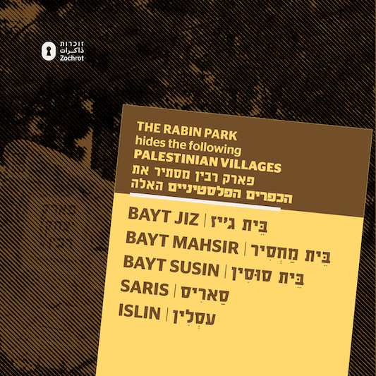
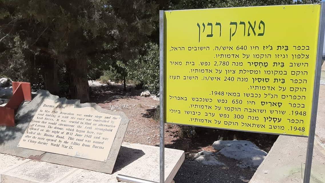
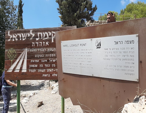
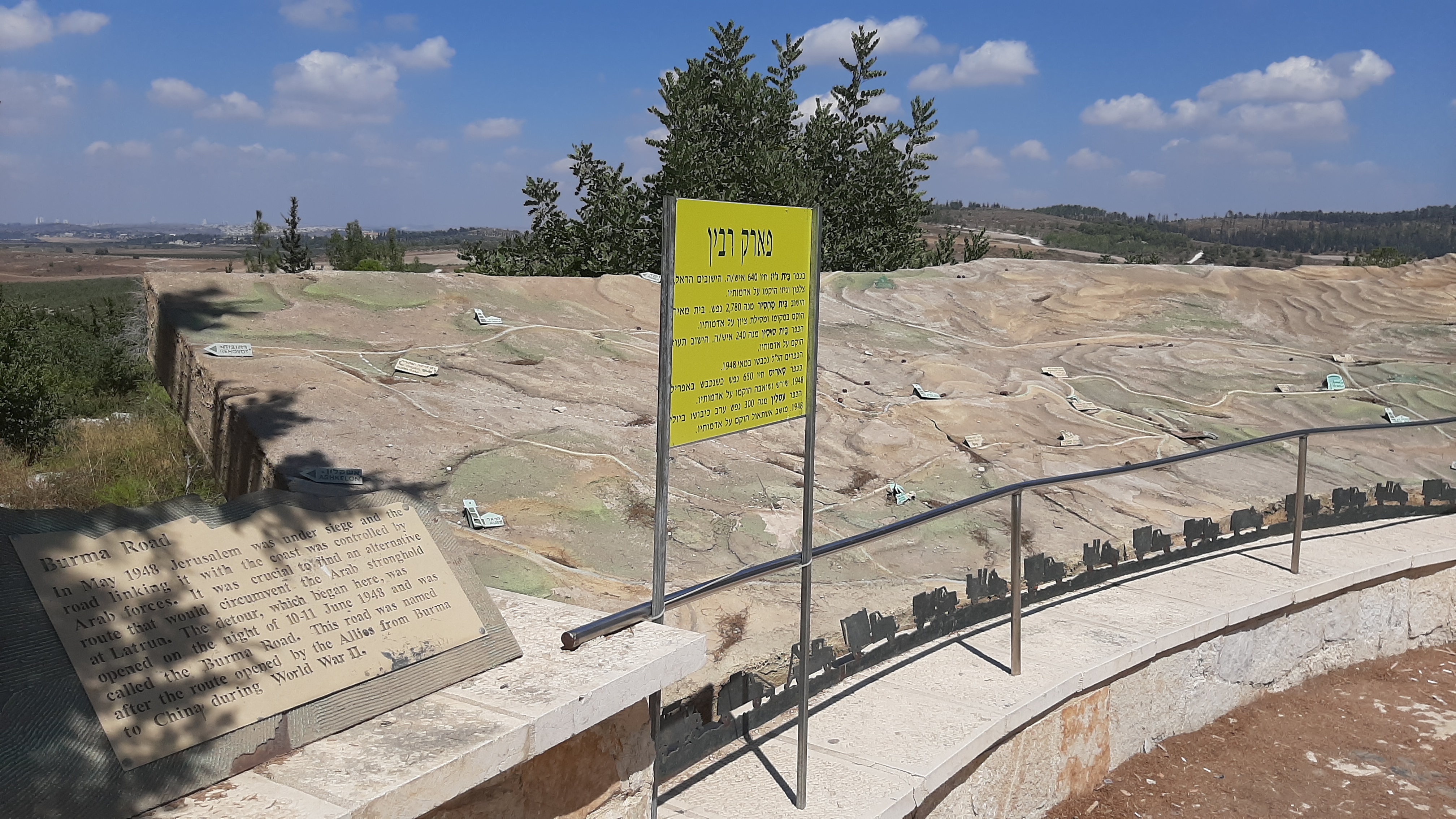
Rabin Park
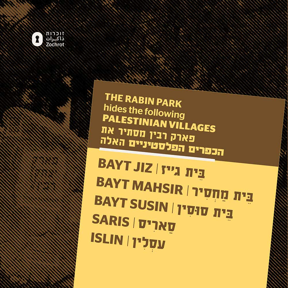
Rabin Park hides the ruins of at least six Palestinian villages, captured and depopulated during the 1948 Nakba: Bayt Mahsir, Bayt Susin, Bayt Jiz, Dayr Ayyub, Saris, and 'Islin.
Together, these villages once held over 5,152 donums of Palestinian land, home to 42,128+ Palestinians, most of whom are now refugees in Jordan and the West Bank.
-
The Ismail Musa R Y Saleh family was forced out of Bayt Mahsir and now lives in Zarqa Town, Jordan.
-
The Ishaq Hasan M Hasan family was expelled from Dayr Ayyub and found refuge in Marka Suburbs, Jordan.
Bayt Mahsir alone had 2,780 residents before its destruction; in its place, the Israeli settlements of Beit Me’ir and Mesilat Zion were built.
Bayt Jiz, with 640 inhabitants, was replaced by Har’el, Zalafon, and Gizo.
Ta’oz was built on the lands of Bayt Susin, which had 240 residents.
Saris, captured in April 1948 with 650 residents, was replaced by Shoresh and Sho’eva.
‘Islin, captured in July 1948, had 300 residents. Eshta’ol was established on its land.
Today, Rabin Park, marketed as a nature reserve and recreation area, erases this violent history. The park’s trails and forests mask the ruins of homes and villages, replacing the memory of Palestinian life with leisure and erasure.
Rabin Park hides:
- Bayt Mahsir
- Islin
- Saris
- Bayt Jiz
- Bayt Susin
Ramat Menashe Park
Ramat Menashe Park conceals the ruins of at least seven Palestinian villages—Abu Zurayq, Abu Shusha (Haifa), al-Kafrayn, Dalyat al-Ruha’a, al-Butaymat, al-Rihaniyya, and Khubbayza—all captured and depopulated by Zionist militias in April and May of 1948.
In total, 45,636 dunams of Palestinian land were seized, and over 86,239 Palestinians were made refugees—most of whom are now displaced in Syria, Jordan, and the West Bank.
For example, the Mohd Said Mohd Sabbah family was forced from their village Umm Ash Shauf and found exile in the West Bank, while the Ghaleb Ibrm Hamad Saleh family was expelled from Umm al-Fahm and now lives in Silet al-Harithiya.
Marketed as a tranquil nature reserve, Ramat Menashe Park masks the violence of its origins. Established after the Nakba, it was built over lands from which Palestinians were expelled, and their homes demolished to make way for Israeli settlements, forests, and military zones. The park’s trails and vistas now draw tourists and locals alike—but beneath its serene surface lies a landscape of dispossession.
As visitors hike through Ramat Menashe, few are aware that the olive groves and hills once belonged to families who are now scattered across refugee camps and exile. This transformation of Palestinian villages into recreational sites is part of a broader strategy of erasure—replacing memory with leisure, and ruins with trails.
Ramat Menashe Park hides:
- Ar’ara
- Abu Shusha
- Abu Zureiq (destroyed during the Dalet military operation, 1948)
- Al Butaymat
- Al Kafrayn
- Al Mansi (‘Arab Baniha)
- Al Rihaniyya
- Al-Mansi (destroyed during the Dalet military operation, 1948)
- Daliyat ar Rawha
- Daliyat El-Carmel
- Ghubaiyat
- Khubbayza
- Qannir
- Sabbarin
- Umm ash Shauf
- Umm El-Fahm (ceded by King Abduallah, 1949)
- Umm az Zinat
- Yoqne’am\Qira WA Qamun
Tel Izre'el
Tel Izre'el hides:
Adolam-France Park
Adulam Park has seized a total of 32,904 donums of Palestinian land.
This made 115,311+ Palestinians refugees, most of whom are in the West Bank and Jordan today.
For example, the Ahmad Mohd I A Ziheira family were forced out of their village, Ajjur, and found exile in Bethlehem, south of the West Bank; the Nasim Ismail Mohd Fadl family were forced out of their village, Bayt Aula, and found exile in Amman New Camp I, Jordan.
Adulam Park hides:
- Ajjur (detroyed during the Yoav military operation, 1948)
- Bayt Aula
- Bayt Nattif (detroyed during the Yoav military operation, 1948)
- Dayr Nakh-khas
- Kh. Umm Burj
- Nuba
- Surif
- Zakariyya
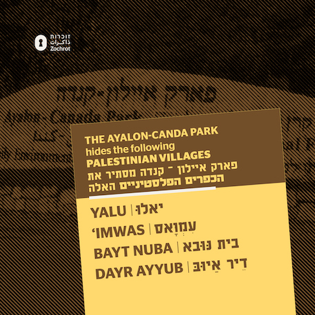
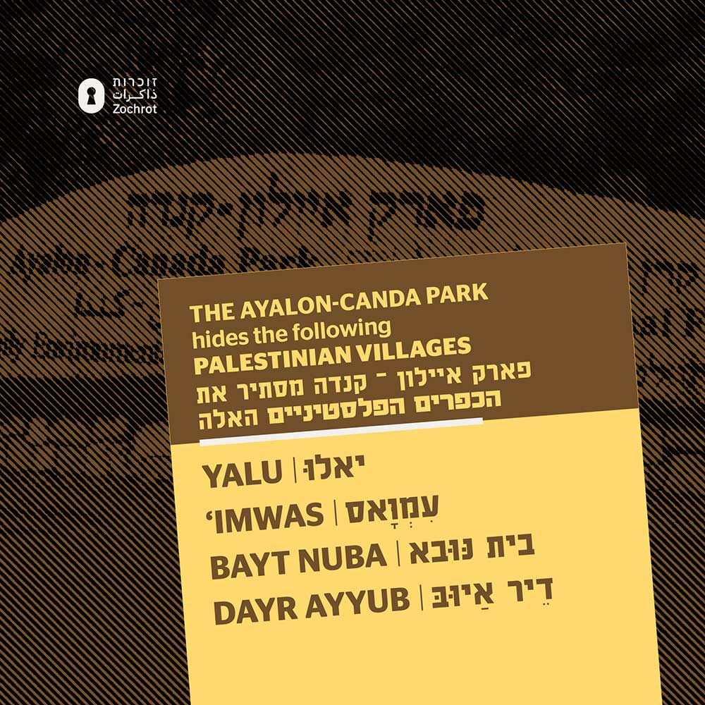
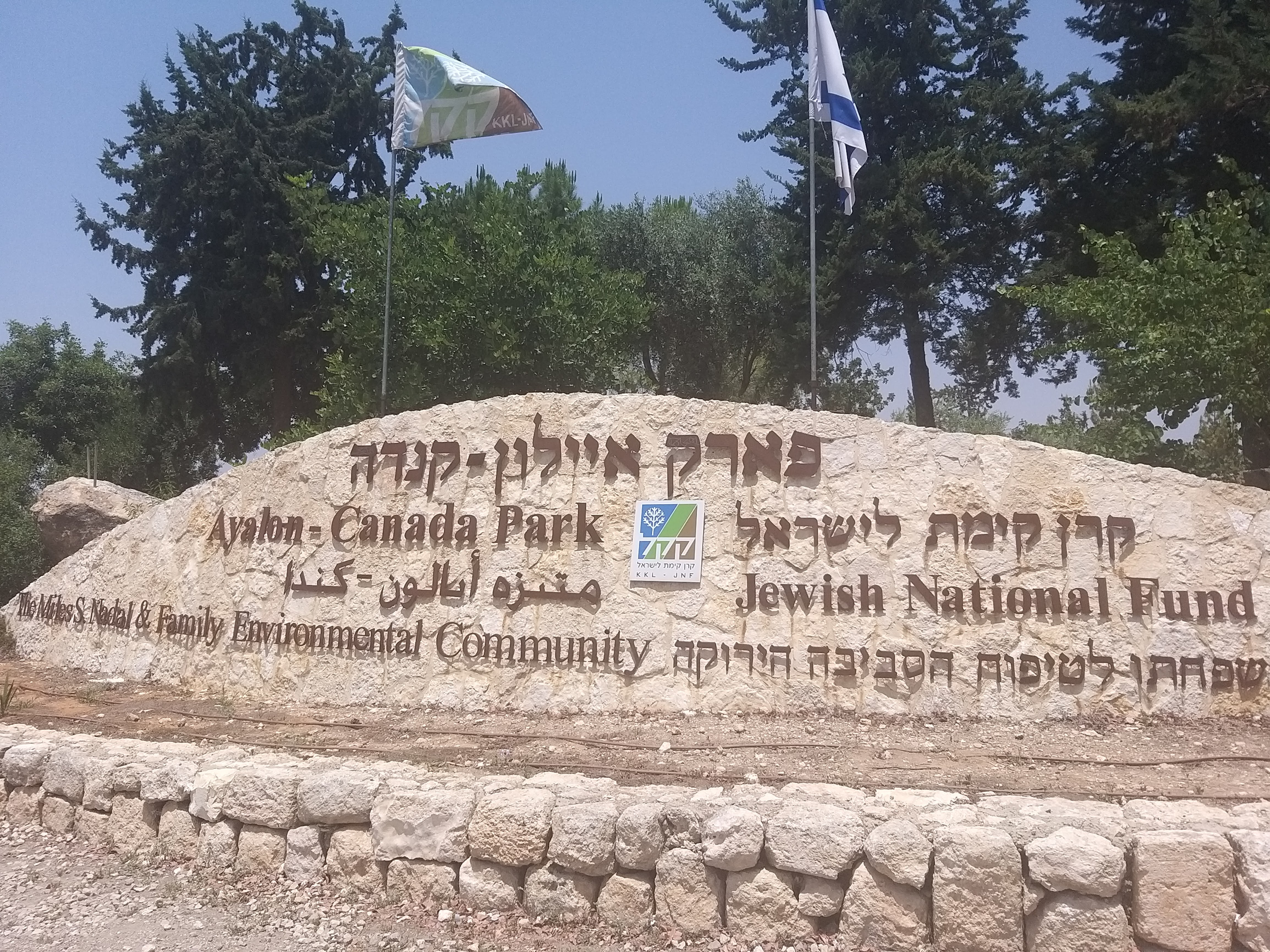
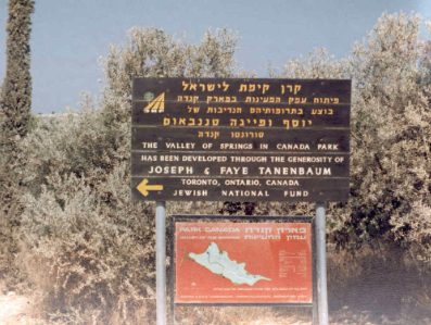
Ayalon-Canada Park
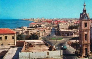
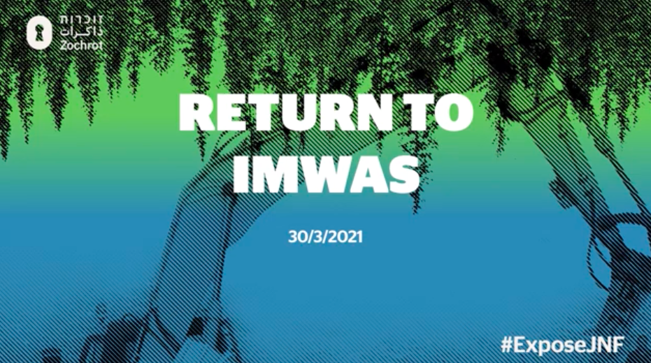
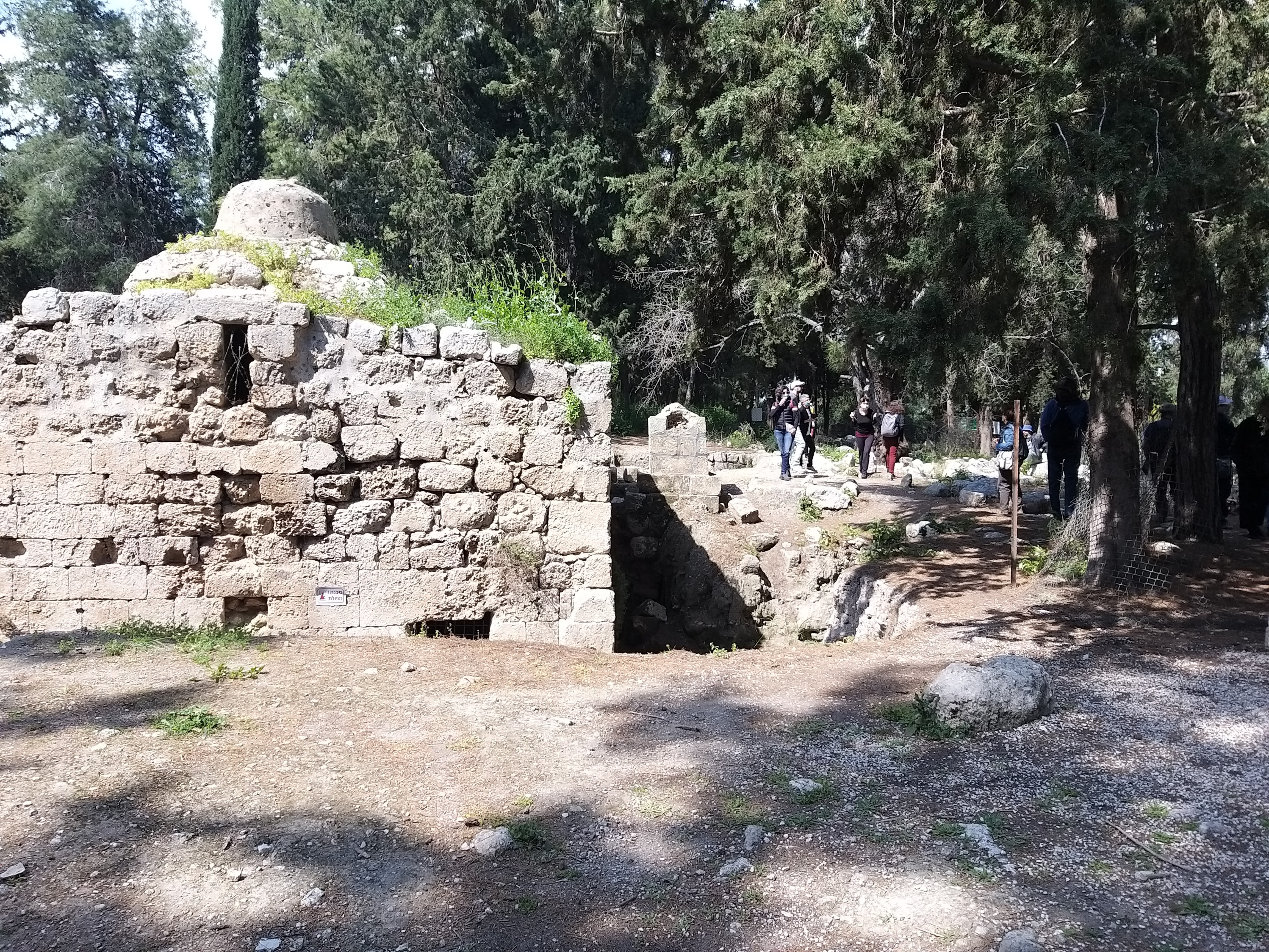
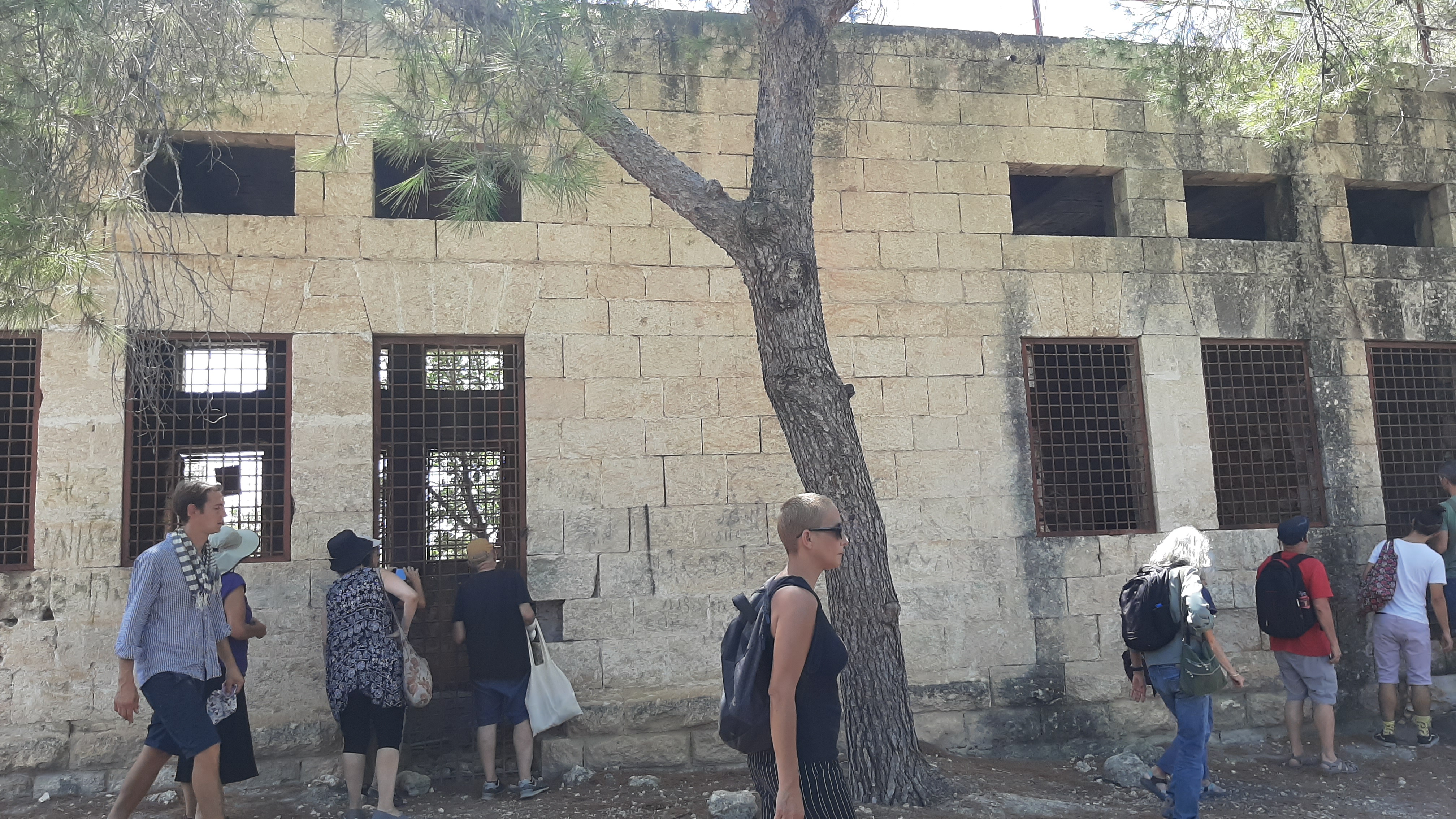
Established in 1972, Ayalon Canada Park stands on the ruins of four Palestinian villages—Imwas, Yalu, Bayt Nuba, and Deir Ayyoub—occupied and depopulated during the 1948 and 1967 wars. Around 6,000 inhabitants were expelled, their homes demolished, and their return continuously denied. Though Imwas, Yalu, and Bayt Nuba were part of the West Bank, the area has been effectively annexed by Israel. The park spans 12,000 dunams and includes part of Israel’s Highway No. 1, cutting through occupied territory.
In the 1970s, the Jewish National Fund (JNF) took control of the Latrun villages, covering the ruins with pine and fir trees—non-native species that contribute to recurring wildfires. Olive trees belonging to expelled Palestinians were seized, and recreational infrastructure was built for Israeli visitors, including playgrounds adjacent to the remains of Palestinian cemeteries. This tactic of erasure mirrors JNF practices dating back to the 1948 Nakba.
In the spring of 2025, Ayalon Canada Park was severely damaged and ultimately closed after massive fires swept through the area. Due to the highly flammable nature of the non-native trees planted by the JNF and the season’s dry winds, the fire spread rapidly, consuming large portions of the park and revealing the fragility of the forest cover used to hide the traces of Palestinian life.
The Ayalon Canada Park hides:
- Yalu
- Imwas
- Bayt Nuba
- Dayr Ayyub
- Al-Latrun
Yehia'm Forest
Yehia'm Forest hides:
Hakarmel Coast Forest
Hakarmel Coast Forest hides:
Aminadav Forest
Established in the vicinity of Al-Walaja, the Aminadav Forest serves as a stark reminder of the dispossession and displacement experienced by Palestinian communities in the area. Before 1948, Al-Walaja was a thriving village nestled on a large hillside, boasting a population of 655 and a flourishing agricultural economy. However, during the 1948 Arab-Israeli War, the village faced occupation and was eventually handed over to Israel according to the terms of an armistice agreement with Jordan. Israeli settlements, including Aminadav, were subsequently established on the village lands, further altering the landscape. Today, remnants of Al-Walaja, such as a few stone houses and an elementary school, stand as poignant reminders of its past, while the Aminadav Forest conceals the history of dispossession and displacement that occurred in the area.
The site of Al-Walaja is now covered with stone rubble and almond trees, with a spring flowing from a stone-and-concrete structure in the valley. The 1948 Armistice line passes through the southern lands of the village, and refugee shelters built by the United Nations Relief and Works Agency (UNRWA) now stand on the land that became part of the West Bank. The village area has been repurposed as an Israeli picnic site, while the Israeli Canada Park lies north of it, perpetuating the erasure of Palestinian heritage and history. Despite these efforts to conceal the past, the resilience of Palestinian memory endures, calling for acknowledgment and justice for the communities that once thrived in this land.
Aminadav Forest hides:
Beit Ha’emek Forest
Beit Ha’emek Forest hides:

 Download the Infographic


